
(Part of a series.)
A while back we made some maps of development patterns in greater Portland, Oregon between 1990 and 2000. And we found—perhaps not too surprisingly—that Oregon’s growth management laws really were effective at protecting farmland from scattered residential development.
Here’s a snapshot view, comparing the Oregon counties in the metro area with Clark County, Washington, north of the Columbia:
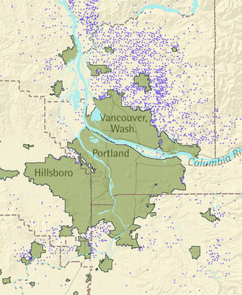

Each purple dot represents 10 new rural residents from 1990 through 2000. Obviously, Clark County, to the north of the Columbia River, had a lot more scattered residential development on rural land than the counties in the Oregon part of the region.
Now, if there were any doubts that Oregon’s growth management laws were responsible for the differences between the two halves of metro Portland, I think we can lay those doubts to rest. The passage of Measure 37, a ballot initiative that partially invalidates Oregon’s growth rules, has led to a flood of new claims for developing farmland on the outskirts of Portland.
Take a look at the map below, detailing residential housing claims (the red squares) under Measure 37.
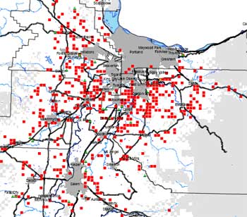

The gray blob at the top is Portland and its denser suburbs; the red dots are where Measure 37 claimants who want to build houses or subdivisions.
Looks pretty similar to what happened in Clark County, no? And while it’s too soon to say “bye-bye” to the farmland around Portland, it seems to me that that’s the direction things are heading in.
(For more detailed maps, see here and here—but beware, they’re huge .pdfs.)