Contact: Eric de Place, eric@sightline.org, 206-447-1880 x105
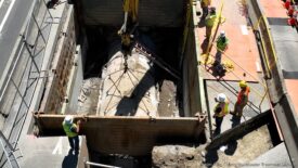
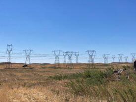
The Lower Columbia River region is more threatened by fossil fuel development schemes than any other place in the Northwest, according to a new report from Sightline Institute that ranks locations throughout the region on their vulnerability to these developments. The report, “Northwest Targets,” provides risk assessments for nine additional communities in a region targeted by fossil fuel corporations as the cheapest route to Asian energy markets, including at-risk locations like Tacoma and Cherry Point, Washington. All places profiled in the report have faced coal, oil, gas, and petrochemicals infrastructure proposals that threaten some of the region’s most iconic natural resources. The report also details innovative strategies some communities are using to fend off these projects.
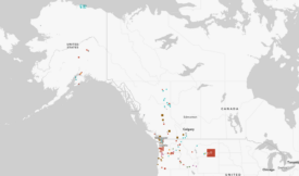
Sightline is also releasing the first comprehensive map of all fossil fuel projects active, proposed, and dead throughout Cascadia, the region encompassing Oregon, Washington, and British Columbia. It’s the most thorough accounting yet of the “Thin Green Line” of resistance and organizing against these projects. The Institute will update the map regularly as a resource to media and the public.
“Northwest communities face real and imminent threats from the fossil fuel industry,” says Eric de Place, report author and policy director for Sightline Institute. “But the last several years have shown decisively that the people of Cascadia can stand up against dirty energy developments—and when they do, they win.”
Find the full Thin Green Line map at www.sightline.org/TGLmap and the report at www.sightline.org/NorthwestTargets.
###
Sightline Institute is a think tank providing leading original analysis of energy, economic, and environmental policy in the Pacific Northwest.