Maps. I love maps. If I were Canadian, I would be a geographer. In the United States, geography is often just a high-school fluff course taught by a coach. (In my high school, it was the cheerleading coach.) In Canada, however, geography is a serious discipline. In fact, the University of British Columbia boasts one of the top departments in the world.
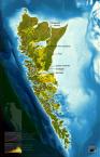
Drawing on this geographical tradition, today’s top story in Tidepool is a map-lover’s gem. The Sierra Club of British Columbia, reports the Vancouver Sun, has created a map showing the longterm effects of climate change on the Lower Mainland of B.C. You can download the map and view it with Google Earth. It looks like rising sea levels will swallow up my old apartment in Kitsilano. (Another wild graphic of climate change, in the April issue—print only—of Vanity Fair, shows Manhattan as a soup of skyscrapers swimming in the Atlantic.) Scared? Well, these maps actually portray the worst-case scenario …