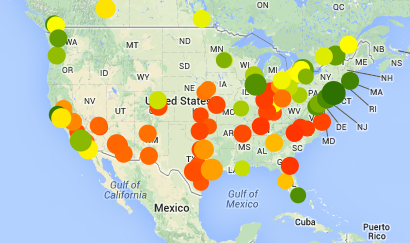
I never get tired of calling the folks over at Walk Score geniuses. The nation’s most widely used walkability measurement tool just updated its neighborhood rankings, using a new and improved algorithm. The news for the Northwest: Seattle clocks in as the 8th most walkable city in the US, while Vancouver ranks as the 4th most walkable city in all of North America, trailing only New York, San Francisco, and Boston. Yay!
As a reminder, Walk Score generates a walkability rating for practically any address in North America, and many parts of the rest of the world as well, by measuring the distance to grocery stores, restaurants, bars, parks and other common walking destinations. The more amenities within easy walking distance, the higher your Walk Score.
The system has always been pretty darn good, but an earlier version suffered from a persistent flaw: it measured distances as the crow flies, not as a real human being would actually walk. In most cases the old system worked fine; but in a few places you’d have to learn to walk on water to actually make use of “nearby” amenities: “crow fly” distances can rate a store that’s completely inaccessible as convenient and nearby.
The new rankings fix that flaw: they calculate actual walking distances, while also factoring characteristics of the street network to help gauge how easy it is to get around on foot. In some places, the new method changes rankings pretty substantially. Consider Roosevelt Island, outside Manhattan—the image on the left shows neighborhood rankings under the old system, in which “nearby” stores in Manhattan and Brooklyn made the entire island look like a bustling hive of walkability. The new ranking system gives a more realistic (and more modest) score:

There don’t seem to be many surprises in the new list of most walkable cities. The cities known for having an active street scene, and where lots of residents get by without owning a car, are generally the ones with high Walk Scores. The spread-out cities—places where strip malls are the dominant form of commercial development—have low walk scores.
The resulting geographic pattern looks like quite a few maps that you may run across in other disciplines—say, the study of the obesity epidemic. And not too surprisingly, it’s the places that developed long before the post-World War II driving boom—the Boston-to-Washington corridor, San Francisco, Chicago, the industrial upper-midwest—that are generally the most walkable, which is a clear reminder that when we design cities around the car, we make it much harder for people to use their feet for anything but the gas pedal.
Update: I swear my brain is getting fuzzy in my old age: in an earlier version I wrote that Seattle ranked 7th in America. It’s actually 8th. Duh.

How does walkability correlate with affordability? While Vancouver may enjoy high walkability, its affordability is dismal and one might wonder if its a significant correlation between the two factors of high walkability and high housing cost.
“Vancouver Housing Affordability Ranks 2nd Worst In World”:
https://www.huffingtonpost.ca/2013/01/22/vancouver-housing-affordability-demographia_n_2526812.html
Affordability is a toughy: walkable neighborhoods tend to be DESIRABLE neighborhoods — the sort of places that people are willing to pay a premium to live in.
I haven’t reviewed the HuffPo article, but I’m familiar with Demographia. Here’s how Wikipedia describes the principal there.
“Wendell Cox is a leading proponent of the use of the private car over Rail projects. He is the principal and sole owner of Wendell Cox Consultancy/Demographia…”
My own impression of Cox’s work is that he tends to cherry pick arguments and data that support his point of view. Housing affordability metrics, for example, ignore transportation affordability — what you spend on housing can be partially or fully offset by savings on private vehicle ownership.
But the affordability issues in compact cities raise an interesting question about land use regulations — often the problem in cities is that regulations prohibit developers from building new housing in places where prices are high. That is, zoning rules that limit new housing development essentially prevent the market from responding to clear signals that people want more housing, and are willing to pay for it. At the same time, rules requiring extra parking in compact neighborhoods increase the costs of construction.
Affordability is a bit like Yogi Berra’s saying — “Nobody goes there any more, it’s too crowded.” Obviously housing is expensive in Vancouver — but that’s because lots of people want to live there, vacancy rates are low, and housing is scarce.
And a last point: most affordability metrics are based on arbitrary percentages of income. If you spend more than 30% of your income on housing, it’s “unaffordable.” But that’s a bad metric: it ignores families in different circumstances (a singleton can spend a higher share of his/her income on housing than a family can), and also ignores the cost of everything else (e.g., household costs for health care in Canada are much lower than in the US).
There’s more to be said on this topic, but I’ll stop here…