Editor’s note: This is the fourth and final installment in a series on how trees and plants help to slow traffic, ameliorate climate change impacts and make growing cities more livable. Read Part 1, which describes the intellectual transformation that’s remaking streets and roads in Cascadia’s big cities, here. Read Part 2, which focuses on Vancouver and its green efforts in busier and denser areas, here. Read Part 3, which focuses on Portland and the strides the city has made with complete streets, here.
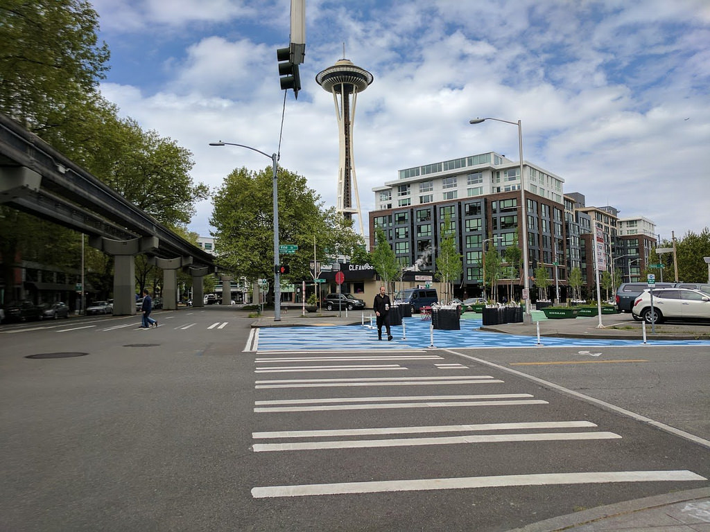
Seattle in many ways has been a North American leader in experimenting with concepts like adding nature to streets to make them better and safer for walking while collecting and treating stormwater. Recently, as the city grapples with some of the fastest growth among big US cities, many anxious Seattleites wonder: Can an Emerald City as famous for arduous process as it is for verdancy move fast enough to implement its best plans in the face of scorching rates of development?
The city was an early adopter of ideas around green and complete streets. In 2007 it became the first big city to adopt a complete streets ordinance, calling for all significant street maintenance and construction projects to also improve safety for people on foot and bike.
In the mid-2000s Seattle also was a pioneer in redesigning streets for managing stormwater with nature and safer walking, remaking a 12-block grid with new sidewalks, landscaping to “enhance the pedestrian experience in the neighborhood”, all while benefiting wildlife habitat and improving water quality.
Since the 1980s the city has designated a number of streets, primarily downtown, as “Green Streets” that are “designed to emphasize pedestrian amenities and landscaping in areas that have dense, residential land uses.”
In 2015, Seattle was among the first American cities to adopt Vision Zero, and created “a plan to end traffic deaths and serious injuries on city streets by 2030.”
Streets Illustrated paints a picture of future streets
Until relatively recently, though, Seattle continued to follow a blueprint for its streets that reflected its 1960s origins. That right-of-way improvements manual required wide lanes for safer vehicle travel at design speeds at odds with urban life, and it designated very little space for vegetation that could help to calm traffic and provide comfort and refuge for people on foot. It is a key reason why Seattleites still see so many scary car sewers in a city that aspires to be “the most walkable and accessible in the nation.”
The updated manual is critical because it sets street-development standards not only for public agencies but also for private developers—the people who are rapidly remaking the urban landscape.
In 2016 the Seattle Department of Transportation (SDOT) adopted an entirely new blueprint for its streetscapes in a design policy dubbed Streets Illustrated. The updated manual is critical because it sets street-development standards not only for public agencies but also for private developers—the people who are rapidly remaking the urban landscape.
Streets Illustrated breaks new ground among US cities in several ways. “In our old manual, we didn’t talk about space needs for complete streets, for transit, bikes, pedestrians or natural functions,” said Susan McLaughlin, urban design manager for SDOT. The manual establishes a dozen street types, each for specific purposes depending on the context, from downtown thoroughfares to urban village Main Streets to slow-traffic neighborhood streets. Almost all emphasize designs aimed at calming traffic and improving comfort and safety for people on foot, with street trees and vegetated landscape zones playing key roles. A citywide map designates which type of street belongs in each neighborhood, business district or urban village.
“Streets Illustrated was a huge move,” says Peg Staeheli, a Seattle-based landscape architect and principal with MIG | SVR who is a designer of complete and green streets. “I think that will be a giant step toward making our city greener. It says you shall have trees, have a pedestrian zone, address safe crossings.”
Active street as park?
In a city growing in population, adding plants not only calms traffic, it can also create new public space. When residents of Belltown, perhaps the densest of Seattle’s residential neighborhoods, were looking for a way to compensate for a lack of parks and green space they asked planners to convert the namesake Bell Street into a “shared street,” or woonerf.
From a Dutch word reflecting the concept’s origins in the Netherlands, woonerfs deliberately blur the lines between pedestrian zones and the travel way for cars, which are meant to travel at walking speed (unless they are barred altogether). In principle, very slow car travel can eliminate the need to design space in the right of way exclusively for vehicles, opening much more of that space to broader human and natural purposes. The lack of curbs that channel water into high flows means vegetated areas can do most of the work of collecting stormwater.
")
Completed in 2014, the four-block Bell Street Park — a joint project of five city departments — adds much needed green and public space to a growing part of the city. Reviews have been mixed. The street still seems mostly given over to vehicles, despite it’s more “park-like” intentions. It is less the green haven than initially intended because it turned out that key electrical and sewer lines ran just beneath the pavement, limiting the planting depth, said Amalia Leighton Cody, an engineer and planter who was a consultant on the project. “Early concepts had a lot more landscaping,” she said.
While Bell Street was a one-off that required breaking just about every rule in the old manual, Streets Illustrated actually sanctions shared streets as a legitimate type with established standards. Others woonerfs may be on the way. For example, a new North Downtown Mobility Action Plan is expected to call for a curbless, landscaped street along Republican Street between Warren Avenue North and Queen Anne Avenue North.
Giving love to trees
Street right-of-way accounts for 27 percent of Seattle’s land area. Streets therefore have to play a central role in the ambitious goal to attain a tree canopy cover — the share of the city where trees are visible in an aerial view — of 30 percent by 2037, up from 28 percent in 2016.
At last count the city had about 130,000 street trees. SDOT currently is updating its street tree inventory, last done comprehensively in 2008. But with development rapidly changing private land, the inventory goes beyond counting existing trees to identifying the sections of right of way that could and should be planted. “Planting strips are an amazing opportunity to add trees,” noted Gordon Padelford, executive director of Seattle Neighborhood Greenways. “There are a lot of places where we can add trees that can stay for a long time, regardless of what development happens to adjacent parcels.”
Changing policy already is resulting in more trees and landscaping in neighborhoods such as South Lake Union, where Amazon and other tech companies have caused office buildings to sprout like mushrooms after a rain. “In the past we would sometimes allow private development to forgo street trees or put them at the back of the sidewalk, rather than between the sidewalk and street,” McLaughlin said. “But that doesn’t do a lot for traffic calming or making a pleasant pedestrian environment.”
The new policy not only requires trees but also mandates enough soil volume to grow large, healthy trees. Emerging technologies and practices also are helping to improve the prospect of a robust tree canopy in the right of way. Innovations such as soil cells allow sidewalks to be built over earth that is soft enough for root growth but strong enough to support the weight of concrete and people. Seattle also is experimenting with replacing tree grates and fences with pliable and permeable “flexipave”, expanding the usable area of sidewalk while allowing the trunk to grow.
Pavement to parks
Like most US cities, Seattle went a little overboard with concrete and asphalt in the auto-only era: Extra-wide arterials, swooping turn lanes, and angled intersections slathered with pavement are remnants of that period. Over the last two years SDOT has been running a pilot “pavement to parks” program, offering residents a chance to show how they would convert unneeded portions of the right-of-way to public space.
For example, SDOT worked with a neighborhood group called Growing Vine Street to show how a triangle formed by Denny and Taylor streets could be repurposed to serve the mission of greening a corridor that flows to Puget Sound. While the demonstration project uses paint on pavement, “We are planning to convert the pilot to permanent,” McLaughlin said, “and hopefully will convert it from pavement to green.”
SDOT has a goal to try out a total of 12 similar experimental sites before starting to convert the most promising into permanent public space. One challenge to doing so will be determining who will maintain the new parklets, whether SDOT, the Parks Department or a neighboring entity, and establishing the standards each site must achieve in each case.
A pivotal moment for Seattle
In the face of rapid growth and competing demands for infrastructure dollars, some might be inclined to place calmer, greener streets in the “nice to have” category. There is a slew of reasons that would be wrong, whether you care about saving lives, squeezing more mobility out of constrained right of way or cleaning the air.
With climate change, planners are looking ahead to a future of more intense rainfall and hoping to use green infrastructure to manage it while adding more green to the urban environment. Seattle is taking inspiration from the Copenhagen, Denmark and its Cloudburst strategy. Begun after the severe flooding that followed a 2011 mega-storm, the plan includes building flood-able public spaces — from parks to tennis courts — and redesigning arterial streets with large swaths of green meant to absorb massive amounts of water during major rains. SPU and SDOT are talking to planners in Copenhagen to learn how the Cloudburst strategy could be adapted to Seattle.
So add climate adaptation to the long list of demands on city streets that includes finding more space for transit, safe and comfortable walking and bicycling, and goods delivery, all while making them lovely and green. Throw into the mix disruptive technologies such as smart-phone enabled vehicle- and bike- sharing and, someday soon, self-driving vehicles. Optimists hold out hope that the need for solo driving in personal vehicles could all but disappear in the city’s core, and technologically regulated speeds could allow for more shared, green streets.
")
Of course that only happens with intention. The city has made bold moves toward people-oriented streets such as establishing 30 mph as the maximum speed for arterials and pushing neighborhood streets to 20 mph and below. But then there’s that Seattle Process to contend with: A project goes through numerous rounds of public outreach and design consultation, only to be derailed by a vocal minority that insists on restarting the process or overhauling the design – often at the expense of traffic calming or safe cycling features.
“We rely too much on top down planning in Seattle,” Padelford said. “We come up with good plans and policies, but community support makes all the difference whether something happens or not. When community members are excited about reclaiming streets for themselves their families and friends, those are opportunities we should jump on.”
But then there’s also the question of leadership. The projects we have been talking about – transforming single-purpose, car-only speedways into multifaceted, people-oriented and green streets – can be complex, requiring multiple agencies to coordinate their work while drawing from various funding streams. That requires focus and direction at the executive level. Jenny Durkan, Seattle’s new mayor, has sent mixed signals thus far, championing a climate plan that takes the need for action seriously, but appearing to back away from projects that deemphasize moving and parking cars.
Seattle has the big ideas, experience and planning vision to show how streets in a densifying city can move more people more comfortably while bringing nature into the mix. With a booming economy and a $1 billion transportation levy, the city even has the wallet, despite angst over rising costs. The question of the moment is whether it will find the will.
