


Takeaways
- Multifamily zoning in the Portland area today is overly restrictive and disproportionately near polluted freeway corridors.
- Oregon’s neighboring states have been addressing this by allowing more home options near major public transit investments.
- A new web tool makes it easy to analyze different homes-near-transit scenarios in the Portland area.
This guest post by Fischer Jemison was first published on his website, urbanpdx.blog.
2025 was a big year for transit-oriented development on the US West Coast. Washington and California both passed major bills that set statewide standards for zoning around transit stations.
In California, SB 79 required cities to legalize 6–9 story buildings near transit, with different standards for higher capacity transit modes. Meanwhile in Washington, HB 1491 required cities to allow mid-rise housing near rapid transit stops, with a funded inclusionary zoning provision where the state will pay for affordable units in new development with property tax breaks.
In the same year, the Oregon legislature continued to iterate on its statewide middle housing program while state regulators established, and moved closer to enforcing, a statewide model zoning code. However, there was little appetite for progress on legalizing housing near transit.
Could 2027 be the year that Oregon catches up with the rest of the West Coast on transit zoning? It should be—the time is right, the need is real, and the state legislature is the right place to make change happen.
Transit-oriented development zoning is a timely issue
Transportation is likely to dominate the legislative calendar for a third year in a row in 2027, with lawmakers once again asked to raise taxes to fund transit operations and road maintenance. A legitimate political problem for advocates seeking new transit funding will be that the revenue efficiency and farebox numbers for the state’s transit agencies look much worse than they did in 2019. On some level, lawmakers are right to ask: How do we ensure that we aren’t merely delaying service cuts for another decade before we’re back in this same situation?
Transit-oriented development (TOD) zoning should be the main answer to this question. TriMet has multiple overlapping issues making its post-pandemic ridership recovery more difficult, but if you look at population density around MAX lines, it’s apparent that land use is a major factor.
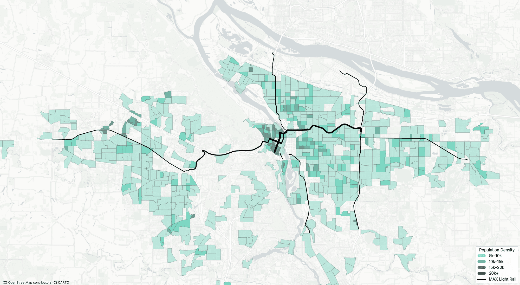
The Portland metro is not especially dense overall, and the pockets of density the region does have often aren’t aligned with our rapid transit service. Pre-COVID, this was less of an issue, but post-COVID it’s made it much more difficult for TriMet to transition from a system focused on downtown commuters to an all-day, all-destination network. Transit zoning doesn’t fix this overnight, but it eliminates a significant barrier to densifying the area around Portland’s transit stations.
And in a session full of bitter pills for legislators, TOD zoning should go down relatively easily. It doesn’t require new taxes or spending, it aligns with the governor’s housing agenda, and, unlike past statewide zoning changes, the impact outside the Portland metro is limited.
Portland’s transit zoning is not where it needs to be
In the United States, Portland is widely assumed to be a leader on the issue of transit-oriented development. In conversations I have had with people who are well-informed on this issue, it is not unusual to hear them express doubt that we’d see noticeable improvements from a Washington- or California-style TOD zoning bill. My research has shown otherwise.
To visualize this, I built an online tool I’m calling BYOTOD, short for “Bring Your Own Transit Oriented Development.” It allows you to set your own rules for a potential TOD zoning bill and shows which lots near relevant transit stations would be upzoned by your rules.
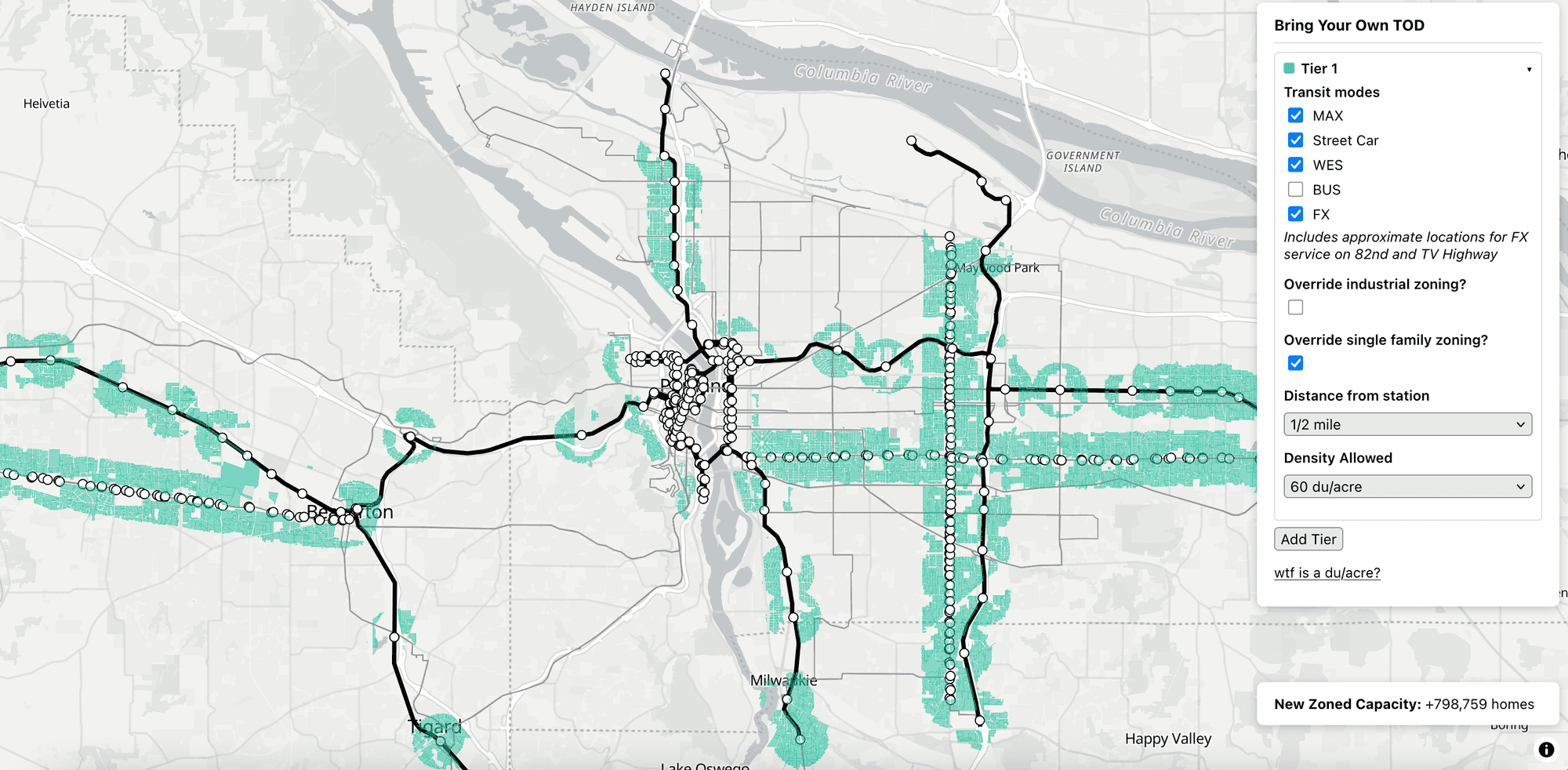
Looking at BYOTOD data, I have several observations:
1. The “catchment areas” of MAX stations are extremely under-zoned
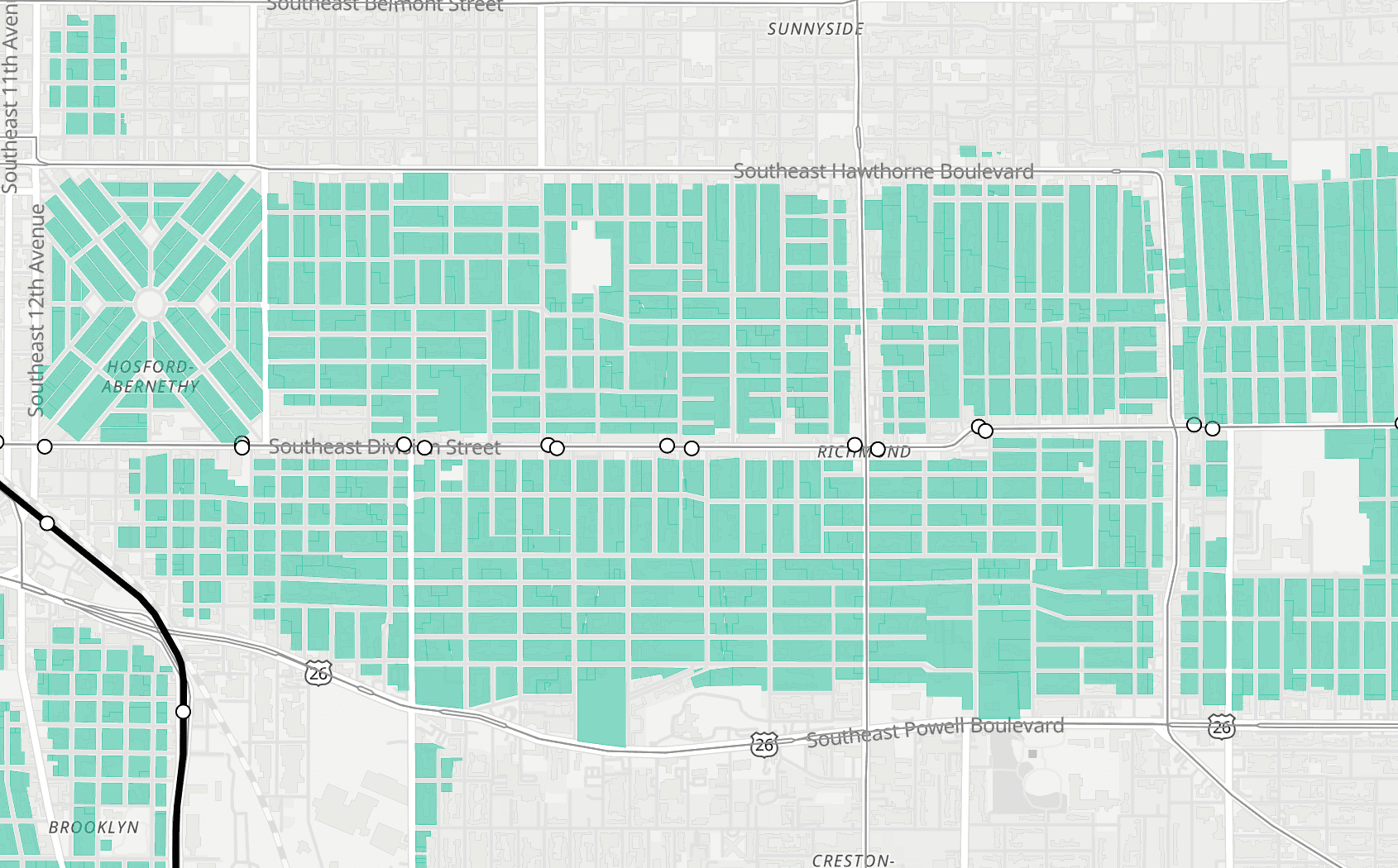
In this close-up, we can see the areas around the Banfield MAX trunk that are zoned for less than midrise density.
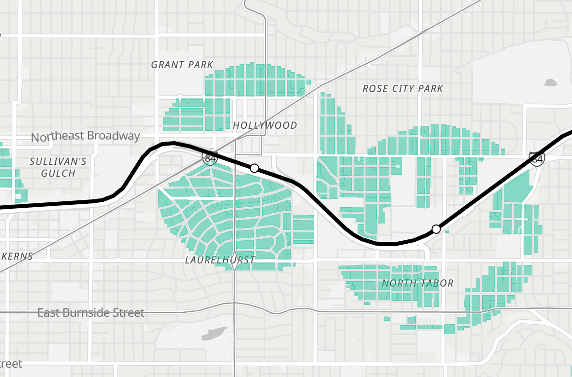
In total, it’s more than half of the “catchment area” of the Hollywood and 60th MAX stations, concentrated in the areas not immediately adjacent to the station. This is consistently true for MAX lines, and it’s significantly worse around Frequent Express (FX) bus line stops.
2. Too much dense zoning is freeway-adjacent
This point is most apparent near the Yellow Line on North Interstate, where nearly all apartment zoning is concentrated east of the Yellow Line and adjacent to the I-5 freeway.
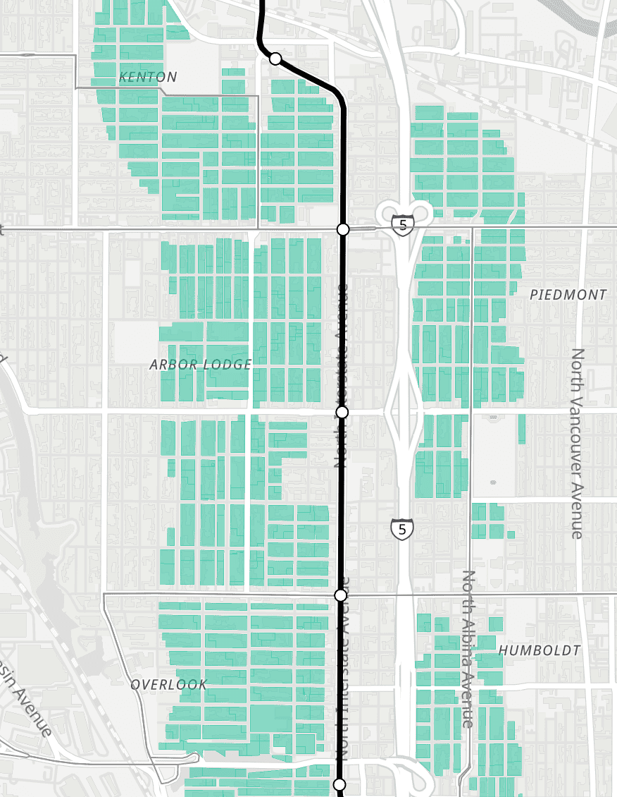
This zoning pattern reserves cleaner air and quieter streets for single-family neighborhoods, a glaring inequity that will only get worse as new apartments in those neighborhoods filter down to lower-income renters.
3. Existing zoning is conservative
Another feature in BYOTOD is the ability to select what level of density should be allowed in TOD zones. The previous screenshots all used 60 dwelling units per acre (du/acre)—put another way, up to six homes on a 5,000-square-foot parcel. This is a fairly conservative choice, roughly equivalent to Portland’s RM2 zone, which in theory allows small buildings up to four stories but has been little used in practice. Other states’ TOD bills have gone much further, allowing closer to 200 dwelling units per acre on lots near transit stops, or up to 22 homes on a 5,000 square foot parcel. If we change the criteria to 200 du/acre, we see that essentially every transit-adjacent lot in the city of Portland is under-zoned.
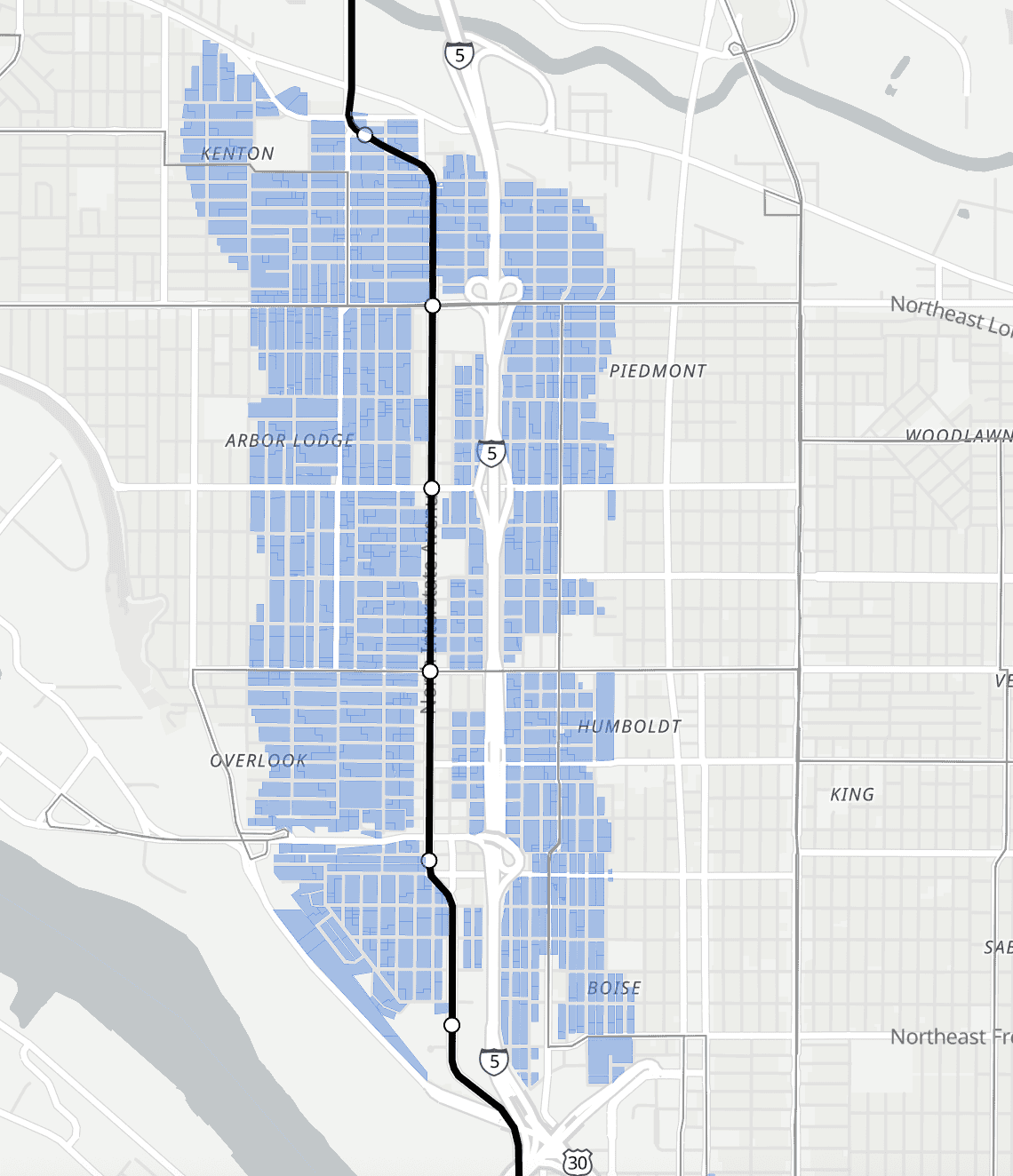
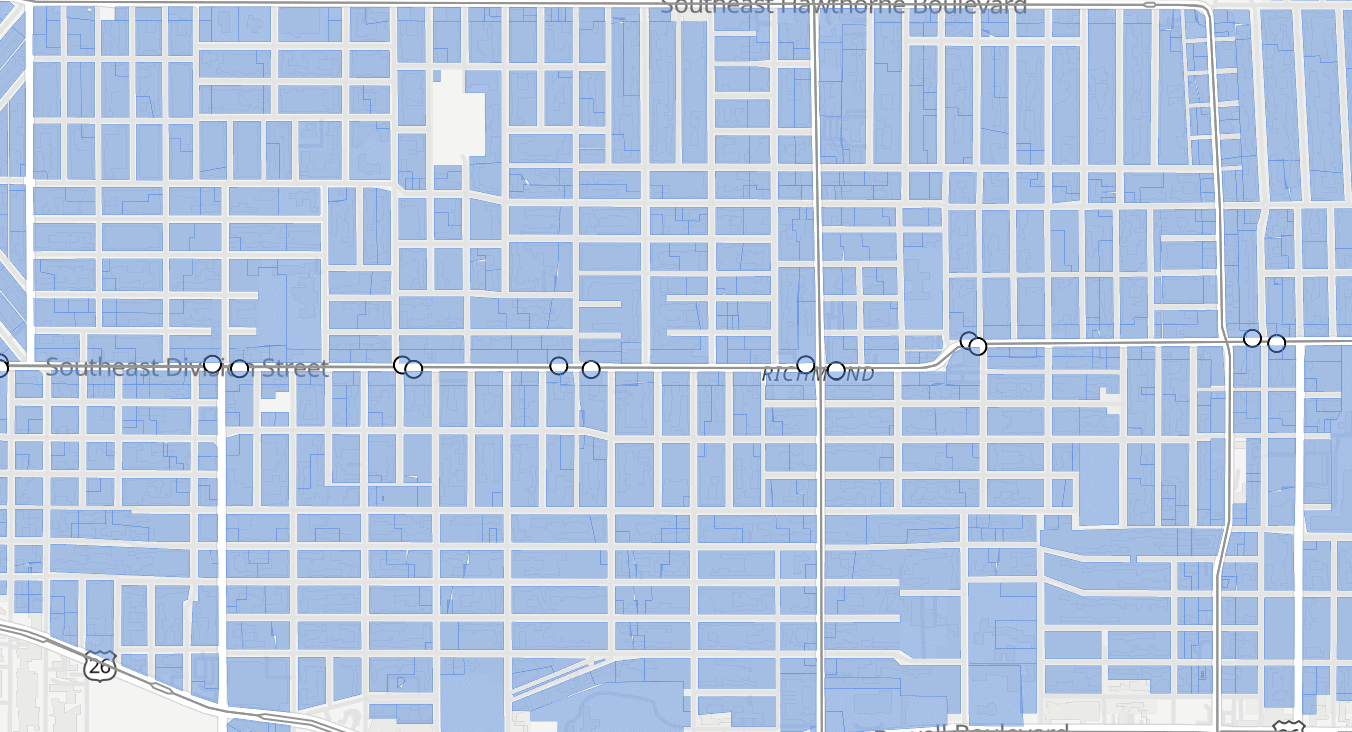
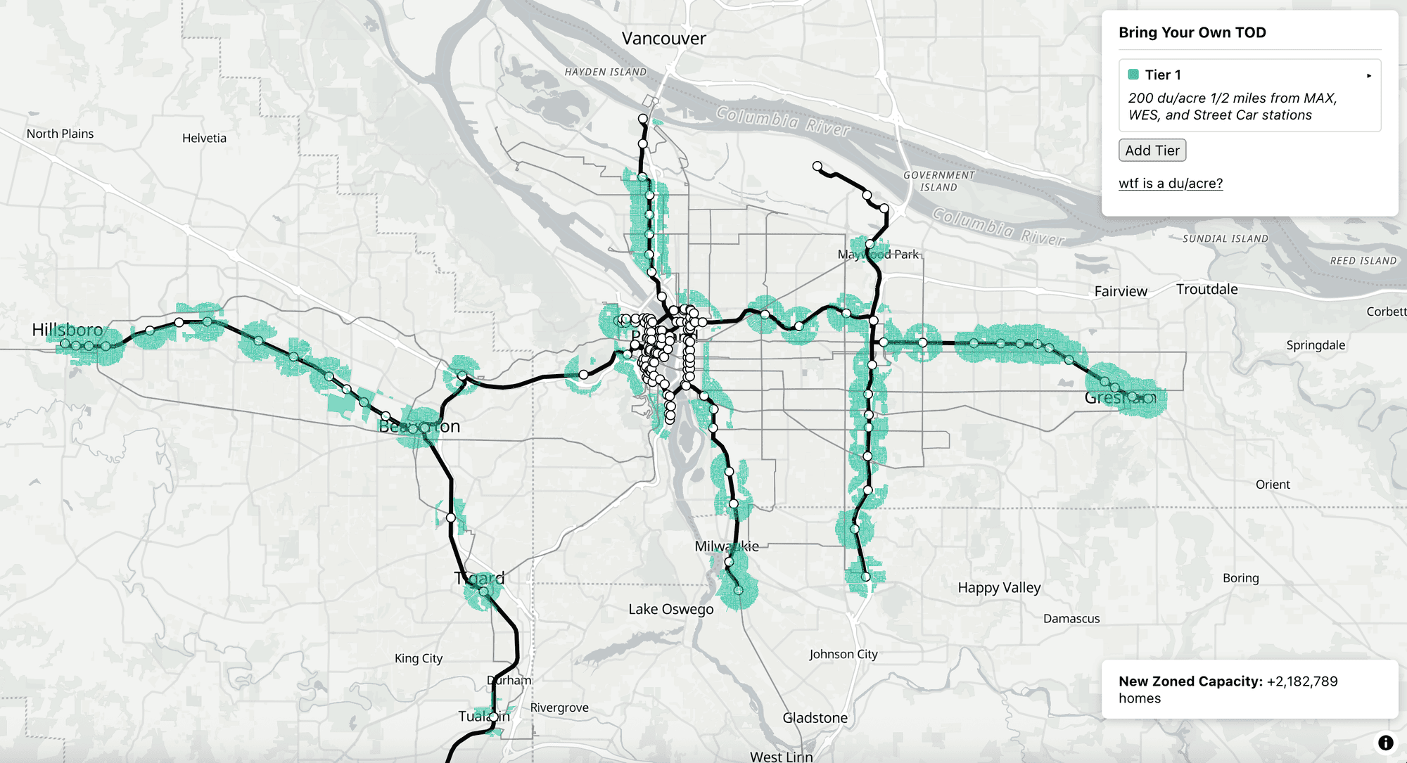
As a result, the tool estimates that zoning lots near light rail and WES stops for 200 du/acre would add a total of two million new units in zoned capacity. The vast majority of these potential homes would never be built, and that’s exactly the point; the only way to give people a real choice of where to live is to allow far more homes than a city will ever actually need.
4. The state has the right legal authority; Metro does not
One reasonable question to ask: Why have the state intervene in a zoning issue that primarily affects Portland when Portland’s Metro regional government has authority over land use and could instruct Portland-area cities to zone more aggressively around transit? The problem lies in section 4(b) of the Metro charter:
Density Increase Prohibited. Neither the Regional Framework Plan nor any Metro ordinance adopted to implement the plan shall require an increase in the density of single-family neighborhoods within the existing urban growth boundary identified in the plan solely as Inner or Outer Neighborhoods.
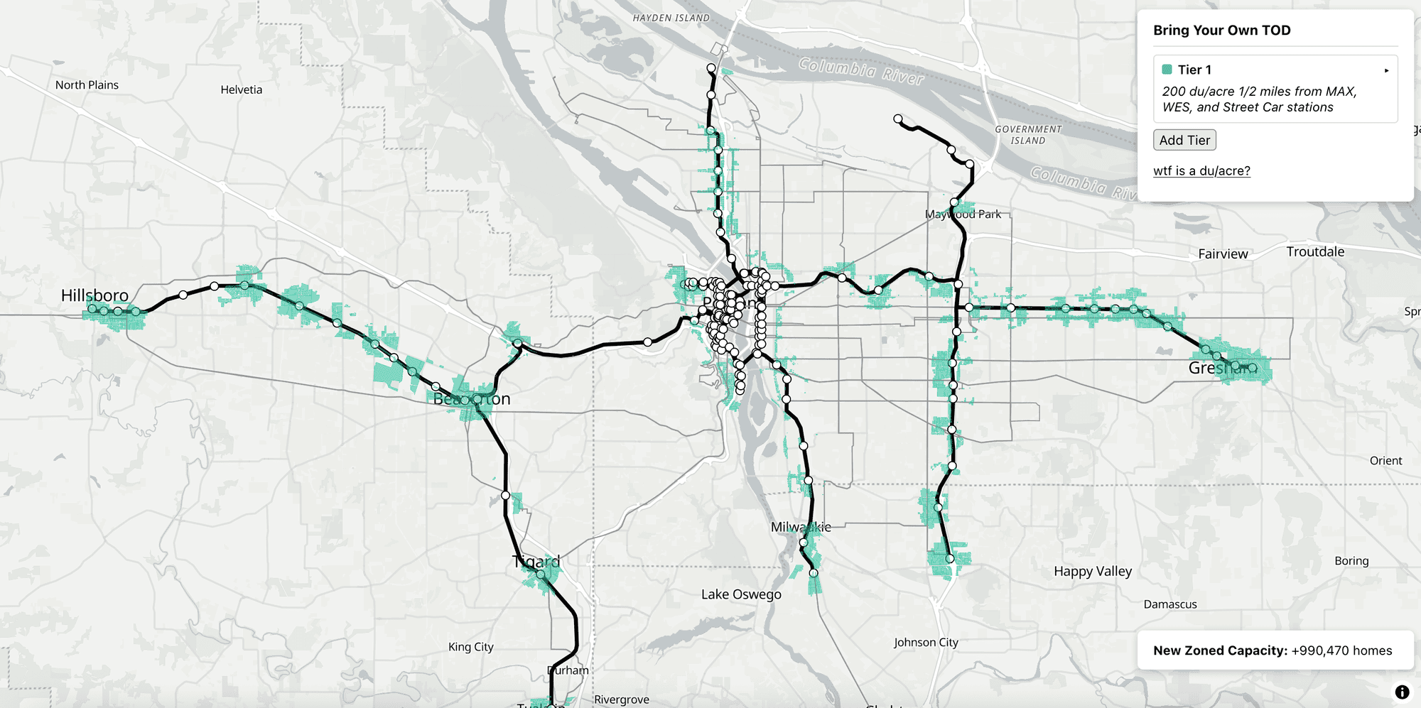
BYOTOD lets you simulate the impact of this restriction by dropping single-family-zoned lots from the TOD analysis. The results are underwhelming: with the area being upzoned significantly reduced, the net increase in zoned capacity drops by more than half. And because most of the land zoned for multifamily buildings already has a multifamily building on it, the number of homes that would actually get built likely drops by even more if we continue to ban larger buildings from so much transit-adjacent land.
While Metro’s legal authority to compel zoning changes is complicated, the state’s is not. American states have plenary legal authority over zoning, and their ability to override local zoning is only restricted by state law.
Moreover, Oregon has new tools that fit this problem extremely well. In preparation for its new housing needs analysis process, the state has developed model codes for cities of different sizes with reasonable minimum specifications for multifamily zoning. With all the groundwork laid for statewide zoning standardization, a TOD zoning bill could simply allow developers to use the model multifamily code near frequent transit stations.
Using a statewide model code for TOD zoning has compelling advantages. It could potentially allow TOD zoning changes to take effect sooner, without waiting for local rezonings. It would sidestep the possibility of local government shenanigans that might delay implementation of the bill. Finally, it would achieve true zoning standardization to allow builders to operate under the same set of rules anywhere in the Portland metro, encouraging standardization and prefabrication that could help reduce construction costs.
The statewide code also has some limitations. It does not have a true high-density zone: at densities of around 100 du/acre, it would be a significant step-up in allowed density around Portland transit but still much less ambitious than what California and Washington allow. It also wouldn’t automatically lead to any local zoning changes, which leads to my next point.
5. Broad transit upzoning could change the politics of neighborhood apartment legalization
When the state of Oregon required cities to drop minimum parking requirements near transit services, the result was that most cities actually dropped their parking requirements entirely. Planners found that maintaining parking minimums in some areas far from transit was simply not worth it, and in most cases opted for the simplest approach—no parking minimums at all.
If we visualize the impacts of a relatively modest bus-oriented upzoning (allowing 30 du/acre within 1/4 mile of frequent bus stops) we can see how a similar policy change for transit zoning might take shape.
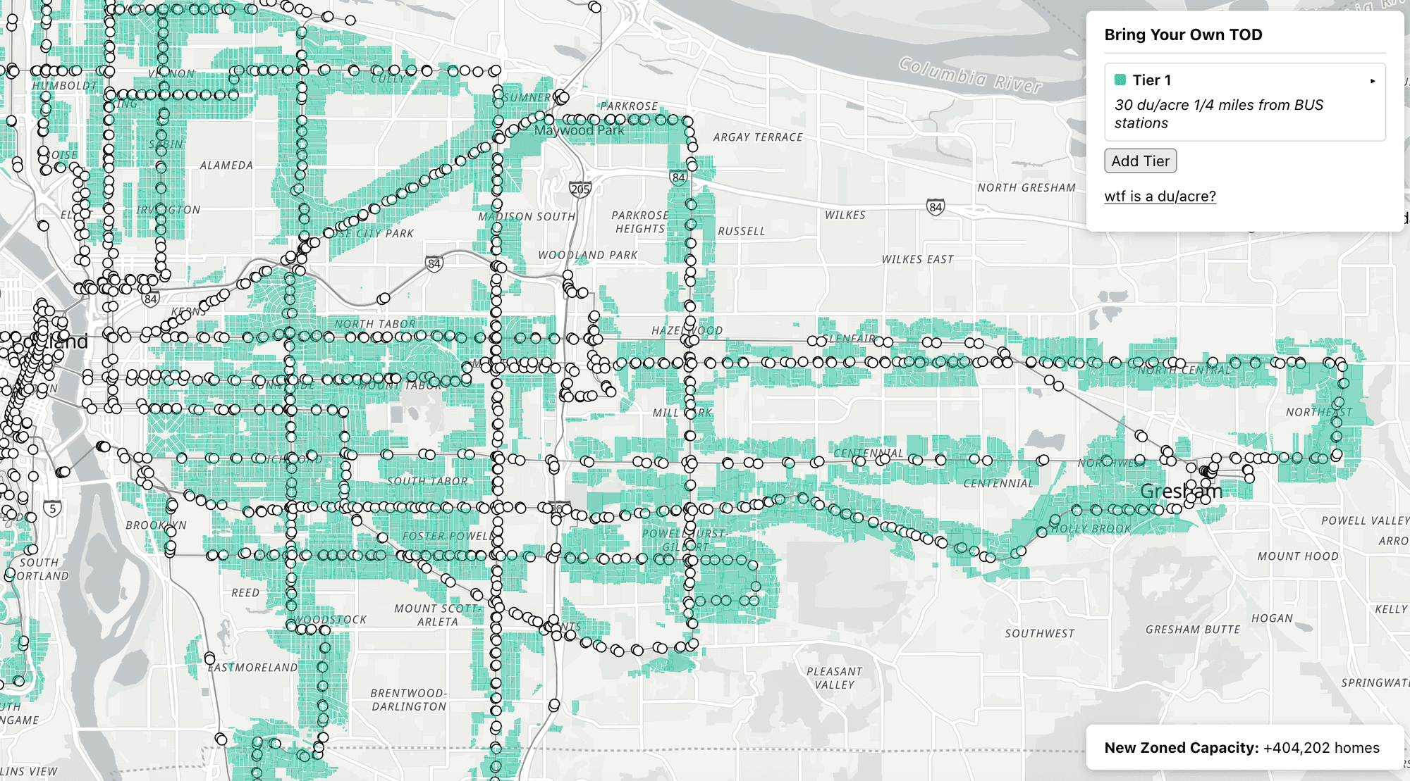
Simply put, many of the lots in Portland and its suburbs are close to a bus stop, and the areas around those lots are zoned even more conservatively than the areas around MAX stops. You can see in the map above how a requirement to zone for modest apartments close to bus stops might have led the city of Portland to develop something like the inner eastside zoning project even absent pressure from housing advocates. The same requirement would likely create pressure for similar zoning changes in Gresham and the inner Washington County suburbs as well. A conservative requirement to allow low-rise apartments near bus stops could lead more cities to adopt something like the “density decontrol” changes that removed caps on home counts in low-rise San Francisco neighborhoods last year.
What about the rest of Oregon?
The Portland metro is the only part of Oregon with light rail transit. But there are other kinds of transit in the state that matter, too. The Amtrak Cascades has stops in Salem, Albany, and Eugene, and several other cities operate frequent bus services like the Emerald Express BRT in Eugene or the Cherriots 15-minute bus network in Salem.
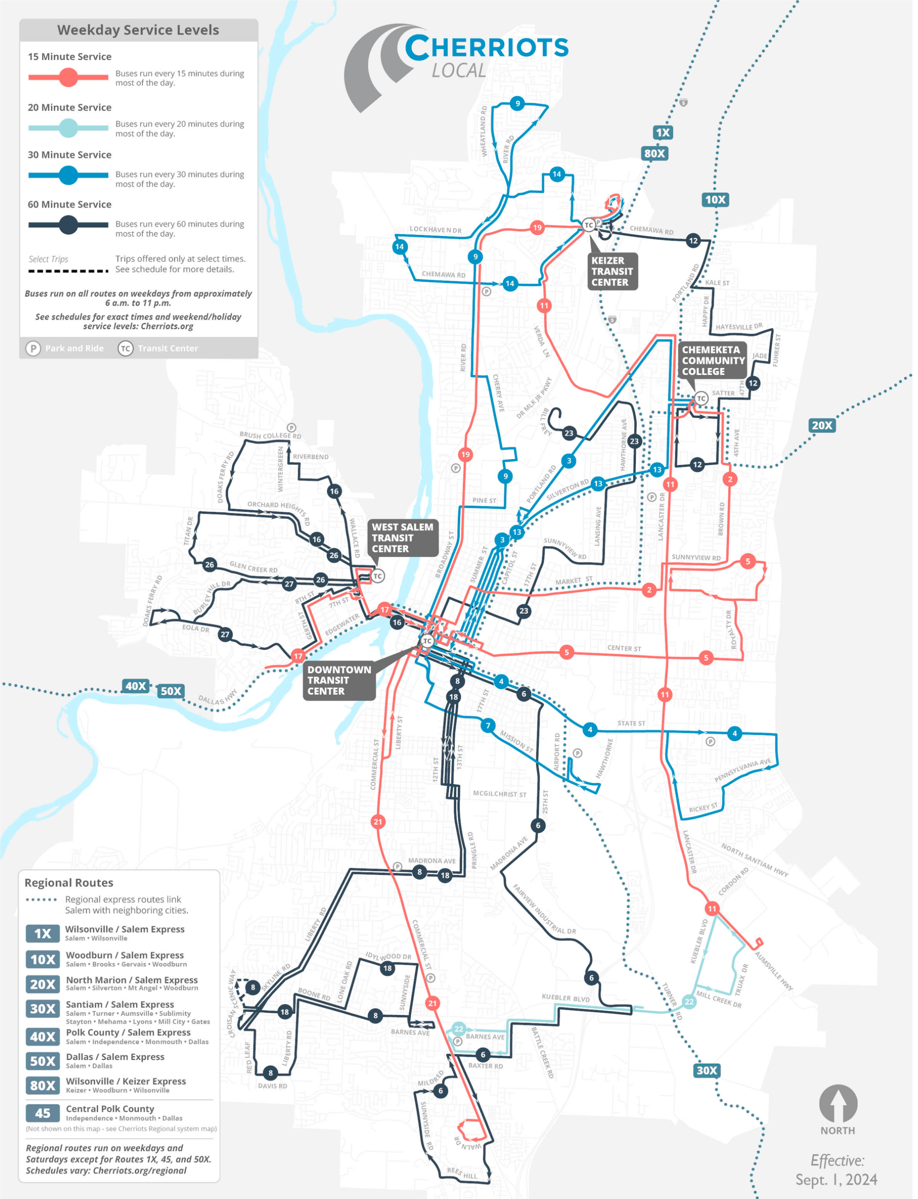
Future transit investments might bring new passenger rail service outside of the Cascades, an expanded WES service, or even light rail in Salem. Consistent transit-oriented development zoning rules could help nurture transit services outside of Portland and ensure that future service expansions will get the land use they need to succeed.
State legislators might also consider what zoning changes would help support future transit expansion in small cities without the density for new transit services today. Instead of zoning around entire transit lines, a small-city TOD bill might focus on regional transit centers or transit destinations like colleges and universities. Unlike big-city TOD zoning, this is not a well-trodden path we can copy from other states, but of course copying other states is not what made Oregon’s land use planning system famous nationwide.
Conclusion: What might an actual proposal look like?
After a while testing out different ideas in BYOTOD, here’s my wishlist proposal:
- 6–8-story apartment buildings allowed within ½-mile of rail transit stops
- 4-story apartment buildings allowed within ½-mile of BRT stops
- 3-story apartment buildings allowed within ¼-mile of frequent bus stops
This would immediately set Portland on the path to ending its housing shortage and preventing future ones. It would also support TriMet ridership in the long term. And it would lead to modest upzonings in Salem and Eugene.
Another idea Oregon should borrow from California is giving more land use authority to transit agencies. SB 79 allows transit agencies to approve the zoning for their own transit-oriented development projects, freeing those agencies from interference by local governments and, more importantly for Oregon, giving a transit agency public developer a more consistent regulatory regime to work under. This would make it easier for Oregon transit agencies to copy Asian transit agencies and use real estate development to support their budgets.
As in other states, the most reasonable path to accomplishing these zoning changes would be to require cities to complete TOD rezonings as part of their next Housing Production Strategy. This fits into existing planning frameworks and allows cities to gradually adopt new TOD zoning rules. To facilitate compliance with the new TOD zoning rules, the state should also consider adding an additional high-density zoning category to the statewide model code that models zoning for high-rise development near high-capacity transit stops: up to a floor area ratio of 4, for example, and up to 125 feet in height.The possibilities here remind me of some comments made by Governor Kotek at the YIMBYtown conference in 2022, as quoted by Sightline:
I think right now I’ve never been more optimistic about the housing conversation. And also more cautious that we won’t get to long-term solutions. Right? People are going to be like, ‘I just want to have the tent off my sidewalk.’ Well, that is a bigger conversation than about just a shelter. That is a conversation about supply; that is a conversation about housing options; that is a conversation about income and wealth inequality. I’m an optimistic sort. Right now, the timing is right to say ‘I have a solution that’s not just a short-term one but a long-term one.’
The timing is right for long-term solutions, indeed. We have a huge opportunity here to help solve intersecting housing, transportation, and climate crises if we have the ambition for it.
Want to build your own transit-oriented development zoning proposal? Check out BYOTOD and share your idea. Reach out on Bluesky if you think the site is missing something that would make it more useful.

